.JPG) Opho Canyon
Opho Canyon
Facts:
Car approach: paved
Hike in: 1 mile
Elevation descent: 700 ft.
Canyon length: 0.8 miles
Total canyon descent: 900 ft.
Hike out: 2.2 miles
Elevation gain: 1600 ft.
Duration: 10:30 h.
Date: 07/04/2014Gear: 2 x 200 ft. ropes, wetsuit: 3 mm or more.
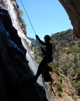
Opho is probably the best canyon we have done in the Sierras. We like it better than Jump. It’s more technical with series of back to back rappels. We descended it with low flow and it didn’t present major problems but with high flow, the narrower section can be dangerous for non-experienced canyoneers.
Car Approach
From Auburn take I-80 East, towards Truckee. At about 24 miles from Auburn, take the exit towards Gold Run and drive to Garrett Rd. After a couple of miles on pavement, where a big pine tree invades the pavement, a short dirt road (50 yards) leads to the camping area. WayPoint: Opho campground, N39° 09.390' W120° 51.149'. That’s where we spent the night. There is enough space for 5 or 6 tents and cars.
Hike in
There are several ways to start Opho. One of the curiosities of this canyon is that one of the options starts by hiking through a 0.3 mile long mining tunnel (bring your headlamps!!). This tunnel has at least 3 entrances. In our case we hiked till the concrete shaft that accesses the NW entrance to the tunnel (0201RappelToMine, N39° 09.745' W120° 50.860') and exited the tunnel at the Opho stream. The access to the tunnel is through a short rappel. Although you will get your feet (and occasionally your calves) wet, you should not put your wet suits on here. After the tunnel, you hike following the stream and suit up after crossing a narrow bridge. At the end of the canyon you hike back to the bridge and to the tunnel exit. You go into the tunnel in the opposite direction you came out and look for a left fork about ¾ of the way to where you rappelled down. Turn left on a low ceiling passage and look for a ladder in very poor condition. That’s your exit from the tunnel. After the ladder there is a short but steep climb. Watch out for falling rock on your fellow canyoneers. You exit the tunnel at 0303ExitShaft, N39° 09.650' W120° 50.794'.
The hike in is just 1 mile and 400 ft. descent. It starts at the end of the camping area. The first 0.2 miles are pretty much cross country on a faded trail. At mile 0.2 and 200 ft. descent, turn left and take the dirt road. At mile 0.5 turn left again. At mile 0.7 you will find a pond on the left of the road. That pond can be a good place to clean any mud when coming out of the mine and before starting the hike out. Just a few yards after (0304Road, N39° 09.643' W120° 50.822') is the waypoint on the road closest to the exit of the tunnel on the hike out. Keep going on the dirt road until WP 0104DropIntoDrainage, N39° 09.765' W120° 50.918' where you go down a small drainage that will take you to the rappel into the tunnel (0201RappelToMine). Put your harness here and neoprene socks but not the wet suit.
Rappel down and follow the wide tunnel for 0.3 miles. There was some running water but less than calf deep. We saw a snake inside the tunnel! At the exit of the tunnel (0202TunnelExitGoRight, N39° 09.740' W120° 50.475') go right and follow the trail downcanyon for 0.3 miles. This section is plagued with poison oak. Cross the bridge (N39° 09.548' W120° 50.370'), downclimb to the stream bed and suit up.
Descent
The total descent is around 0.8 miles and 900 ft. The water wasn’t that cold and some of the team members did it with just a 3 mm. wet suit. The longest rappel is 110 ft. (2 chained waterfalls). Most of the anchors have been recently equipped with dual bolt anchors. At least half of the rappels are wet and in some cases may include crossing the water flow. The canyon can be right before the last 2 rappels. You save come climbing on the hike our but you miss 2 rappels !! This will take you almost at the confluence with the North Fork of the American River.
Hike out
If you exit after the last 2 rappels (0209ExitLeft&Up, N39° 09.113' W120° 50.191'), exit left, go around and climb up on canyon left. Do no cross the American River. Look for a trail climbing next to Opho and not next to American River. If you exit before the 2 last rappels, exit on canyon left and climb up looking for the same trail.
The trail has a few switchbacks along the way and, in general, follows the canyon. After 0.8 miles and 900 ft. elevation gain you arrive to the bridge. Track back the same trail to the tunnel. Remember the poison oak. A few yards before the tunnel, there is a fork to the left that will take you to the camping area but we didn’t explore that option. Instead we went into the tunnel again and used the other exit (0303ExitShaft, N39° 09.650' W120° 50.794'). The exit includes a short low ceiling passage and a short ladder in very poor conditions. Once back on the road (0304Road, N39° 09.643' W120° 50.822'), hike your way back to the car. The total hike out is 2.2 miles and 1600 ft. of elevation gain.


