•Department of Conservation
Photo album:
•New Zealand
Download GPS file:
• GPS track & waypoints
November 26, 2013 – From Queenstown to Sylvan campground
Route profile:
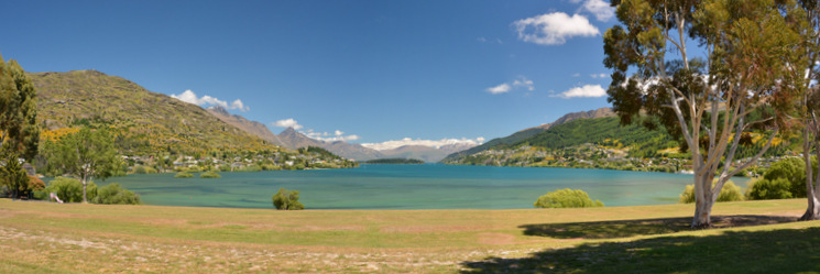
Our landing plan worked out! Here we are, riding our bikes down from the Queenstown airport, where we dropped the rental car, to the Wakatipu lake shore. There is an excellent bike path that goes along the shore from Frankton to Queenstown. At this point we still don’t know it, but Queenstown is surrounded by a fantastic network of bike trails (see our previous to the last day). The path goes through a mix of open views to the lake and the mountains across it, and passages obscured by the trees but equally lovely, as they say down here. The ride takes us around the Queenstown Gardens peninsula and right into the Queenstown marina. It’s a gorgeous day and there are people sunbathing on the lake beaches. The TSS Earnslow steamer is loading passengers to take them to the Walter’s Peak Station. That’s the ferry we are planning to catch on our last day but on the other direction.

Short after we pass the marina the bike path ends and we need to ride on the road. We are headed to Glenorchy first and then to the Sylvan campground, very close to the Routeburn shelter, where the Routeburn track starts. Today’s ride is fantastic but a hard work, especially the first kilometers. On the map, when we were preparing this first day, we thought there couldn’t be many ups and downs since the road goes next to the lake. Wrong!! The mountains around the lake are fairly steep and the road needs to negotiate around the bluffs so it goes up and down quite a bit. The views are superb and although there are several viewpoints along the road, we don't need to stop since we are riding on the left lane (the one on the lake side) and we can enjoy the views most of the time.
At the end of one of the hills there is a must-stop viewpoint. From that vantage point you can see the Pigeon and Pig islands in the middle of the lake and the starting of the lake as well as the snowed peaks in the distance. The road stays hilly until Glenorchy. After the small village, the road has just one more gentle hill. We are approaching the Rees River, one of the rivers that feeds the Wakatipu Lake and the scenery is much more open now. After the Rees bridge, the road is totally flat and still paved up to the Kinloch-Routeburn junction. After that, it's still flat but now the terrain is gravel with some easy washboard.
While the sun is getting low, the peaks in front of us get the last rays of light making the landscape wonderful: green grass in the foreground with playful lambs chasing each other and glowing peaks in the distance.
As we get closer to our destination we go back into the woods and we spot a few hares darting across the road. Just before the entrance to the Mount Aspiring NP, we turn right and ride for one Km to the Sylvan campground. There we met Javi and Erin. While we were munching on the road, they drove by us and were kind enough to stop and ask if we needed something. Javi is from Spain and Erin from the States but speaks perfect Spanish. We chatted with them for a while. They are also doing the Routeburn track starting tomorrow so we will probably meet again. By now, we are fairly tired and we just want to pitch our tent, have dinner and go to sleep. As we finish dinner it starts raining.


