• Logbook
• Road Stars
Photo album:
• Aconcagua P. P.
Download GPS files for Aconcagua PP:
• GPS track & waypoints


In this stage we ride from Mendoza to the Aconcagua Provincial Park, through Uspallata. The park is on the border with Chile and some years ago, to travel to the neighboring country it was necessary to cross the crest of the Andes through the Cristo Redentor pass, at 11500 feet. Today, the road goes through a tunnel of the same name. However, the old dirt road is still passable and can be used to climb up the hill, where a statue of Christ the Redeemer symbolizes the peace between the two countries.
Stage index:
May 13, 2011: From Mendoza to Potrerillos (Profile)
May 14, 2011: From Potrerillos to Uspallata (Profile)
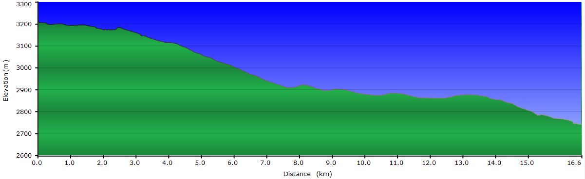
May 15, 2011: From Uspallata to Puente del Inca (Profile)
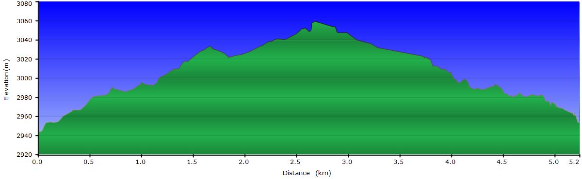
May 16, 2011: From Puente del Inca to Cristo Redentor pass and back to Puente del Inca (Profile 1st part) (Profile 2nd part)
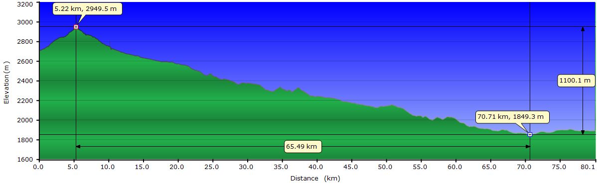
May 17, 2011: From Puente del Inca to Uspallata (Hike profile) (Bike profile)
May 13, 2011: From Mendoza to Potrerillos
Leaving Mendoza by bike, like any big city, it is not rewarding at all. Traffic and pollution are the worst problems. In this case, the slight climb makes us ride more slowly and increases the time it takes us to get out of the more congested area. Route 7 first goes South passing through the wine villages of Maipú and Luján. In this area we can see vineyards on both sides of the road. Half-way we turn west and then North to start the gentle climb towards Potrerillos. The landscape is barren; there is only some vegetation on the banks of the Mendoza River, which we will ride up during the next few days.
The road to Potrerillos is not terribly interesting. No villages or great views. Perhaps the only remarkable thing is the reservoir near the village, but at this time of the year it is much less frequented by people from Mendoza than in summer.
May 14, 2011: From Potrerillos to Uspallata
 We leave the ACA campground through a track parallel to Route 7. A little dog follows us. As much as we try to frighten or accelerate to leave it behind, we fail. When we reach the R7, for a while we hear the honking of cars behind us to scare it away from the road.
The landscape doesn´t change much compared to yesterday’s. The dry slopes are still the dominating scenery but today some have different colors because its mineral content varies. In particular, near the road there is an area where the ground is golden, as opposed to the general dark brown.
 Along the route there are a few tunnels that are usually short and require only a visual check for traffic in both directions and a sprint to pass through them quickly. One of them is too long though, but fortunately we can use the abandoned rail track that runs parallel to the road, as a bypass.
 Some miles ahead, we arrive at the shrine of the deceased Correa. Legend has it that during the civil wars of the 1840s Deolinda Correa followed the movements of her sickly conscript husband’s battalion on foot through the deserts of San Juan, carrying food, water and their baby son in her arms. When her meager supplies ran out, thirst, hunger and exhaustion killed her. But when passing muleteers found them, the infant was still nursing at the dead woman’s breast. In her shrine right by the road there are hundreds of bottles full of water left by the devotees to ask for her favors.
The information office in Uspallata is very useful for planning the next days. Our plan is to go to Puente del Inca and the Aconcagua Provincial Park. Then cross to Chile through the Christ the Redeemer pass and go back through the tunnel to Uspallata. From here we will take a bus to Santiago de Chile and Valparaiso, leaving the bikes in Uspallata. In this way, we avoid the headaches of getting to Santiago by bike and all the hassles of carrying the bikes in the bus. Even one of the persons at the tourist office offers to keep the bikes and panniers while we visit Chile.
May 15, 2011: From Uspallata to Puente del Inca
Although this route is frequented by 18 wheelers, traffic it’s not so heavy or dangerous as we expected. In addition, on the steepest climbs there is a lane for slow vehicles. Today we also have to cross a few tunnels, but like yesterday they are short or can be avoided by the old road.
The first 15 mi run between gentle ups and downs. In this area, the Mendoza valley is very wide, although the river now is a tiny fraction of what must have been in the past. For a long stretch of the road there is a sandy vertical wall more than 60 feet high due to the river’s erosion. The road is dotted with historical references relating to the army of the Andes that freed Chile and Argentina from the Spanish rule, as well as some Inca ruins.

We have tailwind and make good progress despite the steady rise. At mile 35, the road turns right and enters a new valley. We arrive at Los Penitentes, the ski area, and basically a cluster of apartments and hotels on both sides of the road for no more than a mile. We stop for coffee. When we decide to keep going, the wind has changed and now is against us, and will remain so for the 5 miles to Puente del Inca. It’s still sunny and we take some pictures, buy food for dinner and settle in the hostel.
May 16, 2011: From Puente del Inca to Cristo Redentor pass and back to Puente del Inca
Without waking up too early, to allow the sun to rise enough to shed its rays on the narrow valley, we set off to Las Cuevas, where we will take the track that climbs to the Christ the Redeemer pass through the Argentine side.
A few miles from Puente del Inca, from a bend on the road, we can see the Aconcagua, the only snowcapped peak. Its 22841 feet above sea level make it the highest mountain in the world outside the Himalayas. We pass the entrance of the Park, since it’s not today’s goal, and continue climbing to Las Cuevas. On the way there are a couple of tunnels that we can avoid using side tracks.

 Soon we see the arch marking the entrance to the track, before reaching the tunnel. Here begins the dirt road that zigzags up to the statue of Christ the Redeemer, erected to commemorate the peaceful agrement between Argentina and Chile that almost evolves into a war due to a border conflict. This track is the old road before the tunnel was constructed. Little by little we gain altitude. The first half of the climb is over ocher dirt while the second on a maroon one. At the pass, as always, the wind is blowing cold and strong. We are at 11500 feet of elevation. After we put on all the clothes we're bringing with us, we take the mandatory photos at the foot of the Christ and run for the refuge where we warm up with steaming coffee and chocolate. After a while we resume our way and head down at full speed, but not the same way we had gone up, but on the Chilean side. We are in Chile, without stamping our passports. In fact, customs procedures are carried out several miles past the tunnel. From up the pass, we can see a lot of back to back curves, like a snake about to strike. Although the terrain is rocky, the descent is a blast. Half way down we cross a stream with icicles from last night. The second half of the downhill even has the curves closer together. It seems incredible that one could build a road on such a steep slope. We get to the asphalt on the Chilean entrance of the tunnel. As bikes are forbidden through the tunnel (luckily), there is a shuttle service to the other end. What has taken us several hours to go up and down, it only takes a few minutes through the tunnel.

The descent to Puente del Inca is fast. The stalls selling minerals and rocks with different powers and healing properties, souvenirs and handicrafts are still there. Tourists flit from one to another. We go around and get to the hostel for a deserved shower.
May 17, 2011: From Puente del Inca to Uspallata
 Before returning to Uspallata, we go to the Aconcagua Park to get a better view of the peak we had yesterday from the road. The hike from the visitor center to the hanging bridge is short but worth it, since it allows better views of the Aconcagua. Throughout the walk, there is a stubborn cloud that covers the summit. Surely it’s formed by western winds, but it’s the only one in the sky. We sit for a while to enjoy the sun and the cloud begins to disappear slowly. The ribbons that go across the top fade, but new ones are formed on the other side. Finally, around noon it completely disappears and we have a magnificent view of the ridge and south face including the 900 feet thick glacier.
Back to Puente del Inca, we load the bikes and begin the descent to Uspallata. The truck traffic is considerable, but most of them separated sufficiently when they pass us to prevent the vacuum effect. We thought that the descent would be a piece of cake, but a gentle headwind forces us to pedal stronger than expected to reach the village before dark. It’s 50 miles and the obstinate cloud of the Aconcagua has delayed us too much. We get to Uspallata with no problems and head to the bus station to buy tickets for tomorrow’s bus to Santiago de Chile. We spend the rest of the afternoon and evening in the cabin preparing the bags for the trip and dinner.