Death Valley NP:
• Death Valley NP
Download GPS files for Zabriskie Loop:
• GPS track & waypoints
Zabriskie loop
Facts:
Distance: 6.1 miles
Elevation gain: 860 ft.
Total descent: 860 ft.
Duration: 2 h.
Date: 2/18/2012
Description of the route:
This loop starts and ends at the Zabriskie Point parking lot. This hike has the shape of a distorted figure 8 with the trail head at the bottom. It follows both circles of the 8 counterclockwise.
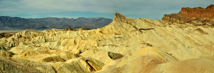
This loop starts and ends at the Zabriskie Point parking lot. The trail head is at the end of the parking lot, just before the uphill to the Zabriskie viewpoint. The trail will take you through colorful strata sneaking around low hills and following washes. The first half of the hike follows the Golden Canyon signs and goes through the badlands from the trail head towards the Manly Beacon, the pointing peak so obvious from the Zabriskie lookout. After this landmark, the trail opens up offering expanse views of the badlands, the salt flats and the Panamint Range on the background. The last section of this first half goes through the Golden Canyon. You will see its mineral rich walls displaying all possible colors: green, purple, red and ochre. The exit of the canyon is at the Golden Canyon parking lot. From here you can return back the same way or complete the loop through the Gower Gulch.
If you decide to go for the loop, take the marked trail exiting the parking lot towards the South. After 0.7 miles you will get to the entrance of the Gower Gulch. Hike upstream the narrow canyon scrambling up in a couple of short spots. After approximately 0.5 miles, the canyon opens up in a wide wash. A very well marked path goes up to the left towards some mines but your trail follows the wash East. Once you meet your own track coming down the Zabriskie Point on a wash, take a right instead of tracking back your footsteps. This trail will take you straight to the Zabriskie viewpoint.
There is also a shorter option which only includes the first ring of the 8.

Zabriskie Loop Profile.


