• GPX file (1 of 2)
• GPX file (2 of 2)
• Profile (1 of 2)
• Profile (2 of 2)
• Logbook
• Where are we?
Photo album:
• Bay of Plenty and geothermal area
Recommended services:
Did you find our website useful?
THANK YOU!
Leg breakdown:
Date Activity Leg Distance (Km) Elev. Gain (m) Elev. Desc. (m) 4-Jan-19 Riding From Auckland to Waitawa Bay 64.6 369 379 5-Jan-19 Riding From Waitawa Bay to Pukorokoro shorebird center 40.8 281 282 6-Jan-19 Riding From Pukorokoro to Tararu 55.1 87 77 7-Jan-19 Riding From Tararu to Waihi beach 72.8 207 205 8-Jan-19 Riding From Waihi beach to Omokoroa 43.6 224 208 9-Jan-19 Riding From Omokoroa to Papamoa beach 40.3 164 172 10-Jan-19 Riding From Papamoa beach to Rotorua 63.2 540 233 11-Jan-19 Riding From Rotorua to Rotorua 9.2 16 13 12-Jan-19 Riding From Rotorua to Waitike 48.1 493 413 13-Jan-19 Riding From Waitike to Wiarakei 73.2 838 806 14-Jan-19 Riding From Wairakei to Taupo 9.6 160 170
4-14 January, 2019: Bay of Plenty and geothermal area
We arrive back in Auckland with a few extra pounds gained in Barcelona (a present from Santa Claus). We pick up the bikes from the workshop and in a couple of days we start rolling. We head towards the geothermal zone of the North Island, located in its north-center, between the cities of Rotorua and Taupo.
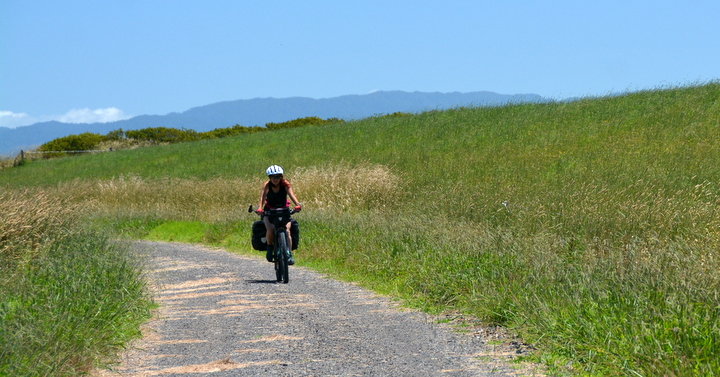
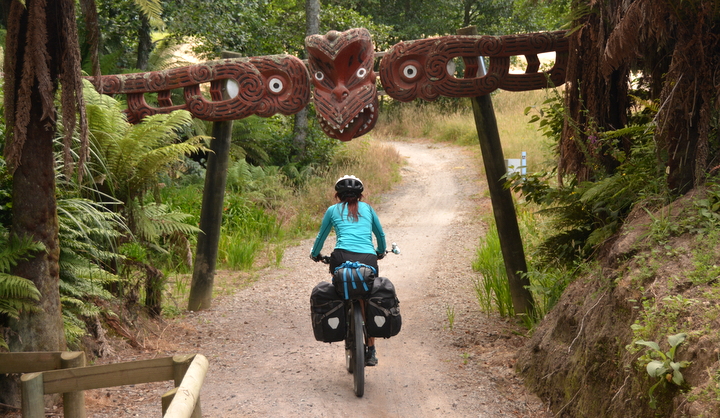
We leave Auckland towards the bay where the Thames River, named by Captain Cook when he explored this area (southwest of the Coromandel Peninsula), flows into the ocean. The landscape of this area does not compare with the far North, but there are still several places of interest. A positive aspect of this area is the amount of dedicated bike trails far away from the traffic, which makes riding much more pleasant. Several of the legs run through what are called Great Rides here. There is even an App that provides information about points of interest along the rides. In this north-central area the Maori presence is more evident, both in the distribution of the population as well as in the abundance of sculptures and symbols in the cities, bridges, signs in both languages, etc.
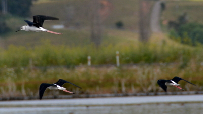
In the next two days, we follow the coast of the Bay of Plenty, the giant bay in the north-center of the North Island. The heat continues to go up, but it’s the burning sun that makes the days harder. This whole area is very agricultural, especially dedicated to the cultivation of avocados and kiwis, and practically no forests remain. After spending the night in Papamoa Beach, we leave the coast and go south towards Rotorua, one of the areas of New Zealand where volcanic activity is more exposed.
 The trip becomes more interesting when we get to Rotorua and especially between Rotorua and Taupo, where there are many geothermal parks. In the heart of Rotorua there is a park with hot water lakes, fumaroles and boiling mud pools. In fact, certain parts of the city smell of sulphurous gases coming from underground.
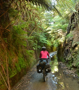
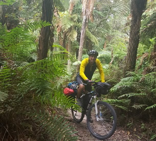
The first day of the route between Rotorua and Taupo runs along a Great Ride bike path. In addition to connecting three very nice geothermal areas, it has a stretch through a lush and shady forest. With our heavy bikes we cannot fully enjoy the single trail, but it's still fun and keeps us in the shade for a few kilometers.
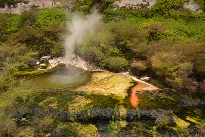
The second geothermal park is in Wai-o-Tapu. The formations that have impressed us the most there are the champagne pool and the devil's bath. In the champagne pool there is a constant bubbling of underground gases that gives it its name. In the submerged zones near the shores, antimony minerals accumulate with its characteristic orange color. The irregularities above the water surface are minerals with white silica, which contrast with the orange that surrounds them. The water has a green hue due to the amount of dissolved minerals. The wind swirls a mist of mystical vapor, creating a special atmosphere.
.jpg)
Another highlight in Wai-o-Tapu is in the devil's bath. The names related to hell and the devil with which the geothermal formations are baptized are a constant throughout the world. It is not surprising if one imagines hell as a hot and foggy place, with flames everywhere and stinking of sulfur. The devil's bath is a small pool of a spooky green color that only exists in the supernatural colors palette. It is a lime green, almost reflecting, but the water seems thick, more dense than normal. And it is too tranquil. In the other formations we have seen, there are informative panels explaining which minerals compose the different structures. Yellow for sulfur, purple and pink for manganese, white for silica, etc. In the devil's bath there is no explanatory panel. The last one we remember, a hundred meters behind, had comments about arsenic, antimony, molybdenum (elements of the periodic system that are surely very poisonous), as well as hydrochloric and hydrogen sulfide, two of the most corrosive acids. Possibly, all of them flow down the slope and mix here. We would not be surprised if the swallows flying over it and nesting in the walls of the crater have a reduced life expectancy. Or maybe when it gets dark their eyes glow with that evil green color and they grow fangs and claws...
.jpg)
But the third of our visits is the best: Waikite Valley Thermal Pools. A set of pools with hot water at different temperatures fed from a nearby geyser. Some of the pools are very neat, among ferns overlooking the steaming river. And they also have a campsite where we can spend the night. A perfect end for today. The temperature of the pools ranges between 35 and 40 degrees and they have all kinds of minerals that for sure are super healthy and beneficial for the body. With the heat accumulated in our first pass through the pools, we take a walk to the geyser that provides these pleasures. It is not a geyser that explodes periodically, but a constant flow of water that bubbles out. Ferns and dense vegetation surround it. The water comes out at 90 degrees, so we assume that at some point they mix it with cold water to not scald the customers. On the way back we submerge in the warm water again for another recovery session for our muscles.
The star visit of the next leg to Taupo are the geothermal terraces of Orakei Korako. To get there, you have to cross a lake by boat. Once on the other side, after a few steps you find the emerald terrace. In addition to the incredible gamut of colors and fantastic shapes of minerals and microbes, it has a geyser that erupts every few minutes. When it does, first it sends a warning with a somber gargle and then vomits boiling water in gushes from the top of the terrace wall. The steaming water goes down the naturally colored steps until it reaches the flat area where its temperature has dropped enough to allow microbial colonies to grow. A little further along the route is the devil’s throat. A cavity surrounded by pink and purple minerals that emits deep guttural sounds and spits out boiling water. In another area there is a crater with dense bubbling mud where the mud bubbles seem to explode in slow motion. Dark brown lines are formed between the bubble spots on the surface of the steaming mud. It’s one of those cases where nature strives to create fantasy scenes. In this park there is also one of the few geothermal caves on the planet. At its bottom there is a pool of warm crystalline water where the Maoris women prepare for special occasions. In another of the gushing holes, spectacular sulfur crystals have formed. The gases that come out of the opening are sulfuric and build up slowly making magnificent yellow branches grow like coral.
Since we left Auckland, the sun has been too strong to pedal comfortably, so we have decided to fly to Queenstown, South of the South Island, to spend the peak of summer there. Although this means a rupture for the geographical continuity of the trip, we prefer not to suffer so much heat now and then, in addition, to be cold in the austral autumn when we would arrive to the South. After touring around Queenstown, we will continue pedaling north. So in the next episode we will tell you about our adventures in Fiordland, the southwest part of the country.© 2018 Explore Pangea. All Rights Reserved. Website Terms of Use.
.JPG)
.JPG)
.JPG)