• GPX file
• Profile
• Logbook
• Where are we?
Photo album:
• The West Coast
Recommended services:
• Gentle Annie campground
Did you find our website useful?
THANK YOU!
Leg breakdown:
Date Activity Leg Distance (Km) Elev. Gain (m) Elev. Desc. (m) 20-Mar-19 Riding Pleasant flats to Haast 48.1 228 325 21-Mar-19 Riding Haast to Lake Paringa 49.9 412 399 22-Mar-19 Riding Lake Paringa to Fox Glacier 71.7 389 252 23-Mar-19 Riding, Hiking Fox Glacier to Franz Josef Glacier 53.7 882 873 24-Mar-19 Riding Franz Josef Glacier to Ross 107.0 651 757 25-Mar-19 Riding Ross to Hokitika 24.0 26 20 28-Mar-19 Riding Hokitika to Punakaiki 88.8 332 326 29-Mar-19 Riding, Hiking Punakaiki to Westport 71.1 597 608 30-Mar-19 Riding Westport to Mokihinui 62.9 175 172 31-Mar-19 Riding Mokihinui to Karamea 55.2 586 592 2-Apr-19 Riding, Hiking Oparara arches 58.3 701 714 3-Apr-19 Hiking Kohaihai to Heaphy hut 16.4 126 132 4-Apr-19 Hiking Heaphy hut to Mackay hut 19.3 680 33 5-Apr-19 Hiking MacKay hut to Perry saddle hut 23.4 419 248 6-Apr-19 Hiking, Riding Perry saddle hut to Brown hut 32.7 38 842 Total 782.5 6242 6293
20 March to 6 April, 2019: The West Coast
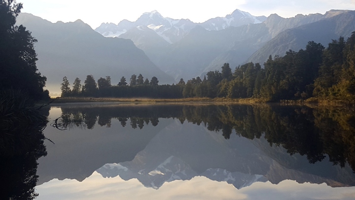
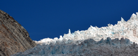
Our tour of the South Island’s west coast starts a bit disappointing. The first points of interest are the Fox and Franz Josef glaciers. We get the impression that tour operators continue to present them as great attractions but in reality they are not anymore. It seems that during the last years the fronts of both glaciers have retreated considerably. Each year you have to walk for longer to get closer, but even so, each year they look farther away. There are people who say that the only way to see them well is by helicopter, which by the way, fly over the area constantly. In fact, we don’t even get close to Fox glacier. Instead, we prefer to go around Lake Matheson at dawn. The lake is surrounded by forest, the water is absolutely calm and the reflection is perfect, both of the vegetation that surrounds it and of the mirror stars, Mount Cook and Mount Tasman.
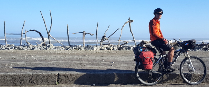
Hokitika serves us as a refuge from the coming storm. When we arrive, the Hokitika River only covers one-tenth of the width of the 300-meter long bridge. After a couple of days the water runs from bank to bank and at a considerable speed. At the river mouth, the turbulent water of the river and the waves of the agitated sea fight creating a scary area. The waves deposit in the nearby beaches the trunks that the river has dragged down from the mountain range. In Franz Josef, the metal bridge through which we crossed four days ago, has been washed away by the water that flows down from the glacier. Such was the flow that the bridge was bent by the current like butter. State highway 6, the only road that runs along the west coast, is closed at that point.
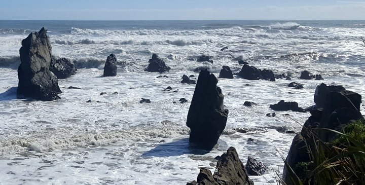
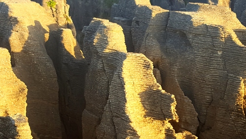 Our next destination is the Punakaiki pancakes, in the Paparoa National Park. It is a very curious limestone formation. The marine sediments of which they are composed, are stratified in hundreds of layers of equal thickness. The erosion of the waves, has left an intricate set of isolated multilayer towers above sea level. Underwater, there is a maze of caverns and tunnels. We arrive at the optimum moment with the conjunction of the high tide, a sea still stirred by the storm and the sunset. Waves squeeze between the towers into dead ends. The water pushes itself through the underground tunnels. The pressure that accumulates is such that in a blow hole, the water rises first about 10 meters through a chimney and then 10 meters more into the air. With the sun low, almost on the horizon, the water spray generates a rainbow as it approaches us and disappears when it wets our faces.
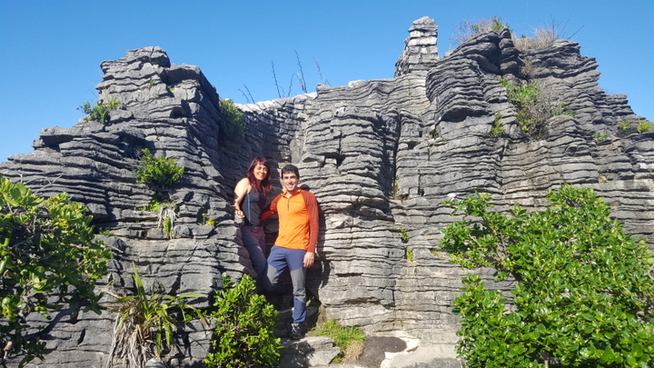
The next morning we do a short walk through the park. We hike the Pororari river upstream and the Punakaiki downstream. One particularity of this park is that the land is composed partially of limestone, very easy to erode. During the walk we can see cliffs excavated by the Pororari, hidden between giant ferns and Nikau palms, both very abundant species in the park.
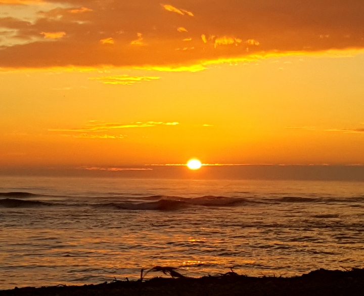
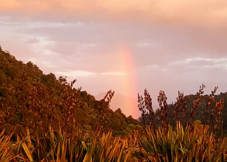
The sunsets on this coast are spectacular but one in particular has been special. In Mokihinui, while the sun hides among the clouds of the horizon, a rainbow of warm and faint colors forms in the East, between the beach and the mountains.
 That night was also special. Our gear are starting to fail. Cèsar’s footwear has the sole so smooth and thin that he can feel any pebbles he steps on. It also has a huge hole next the big toes that makes the gore-tex fabric useless. They drain very well, though. The tent is almost new, but it’s not performing well. Despite having chosen the same brand as the one we had before (it lasted 15 years, including the year riding in South America), the inner layer has begun to tear in the zipper area next to the doors. We are in contact with the manufacturer and they have recognized they have stopped manufacturing it. We have sent them a report with all the defects we have found and possible improvements. We will return it at the end of the trip, unless they change it for an improved version. The backpacks that we take on the hikes have broken a couple of times. The stitches that join the straps from the shoulders to the base of the backpack are not strong enough. We have had them repaired and they are holding for now... The worst has been the inflatable sleeping mat that we bought it especially for this trip. We were tired of the gap that was always between our previous single mats, so we bought a super duper double mat. It looks like one of those beach inflatable mats with longitudinal compartments, like a pack of hot-dogs. Well, since Judit likes to sleep on a hard mattress, we normally inflate her half to about a million psi of pressure. The first disaster happened one of the few days we have stayed two nights in a row at the same campsite. We left the mattress inflated during the day. When going to sleep, the surprise was that two of the longitudinal baffles had become one, with the corresponding bump. Most likely, the inner wall that separated them had detached from the upper or lower layer as a result of the increase of temperature during a sunny day. Luckily those two franks (now turned into a bratwurst) are close to the side and only make the usable part of the mat narrower. So we have been sleeping closer for a couple of weeks. But while pumping the mat in Mokihinui, two other interior walls fail at the same time. On top of that, they are contiguous walls, forming a triple sausage which is right next to the double that already existed. That night Cèsar had to sleep belly down, with his arms and legs straddling, hugging the giant sausage. From now on, a rotating system will be put in place to choose who sleeps in which half of the mattress.
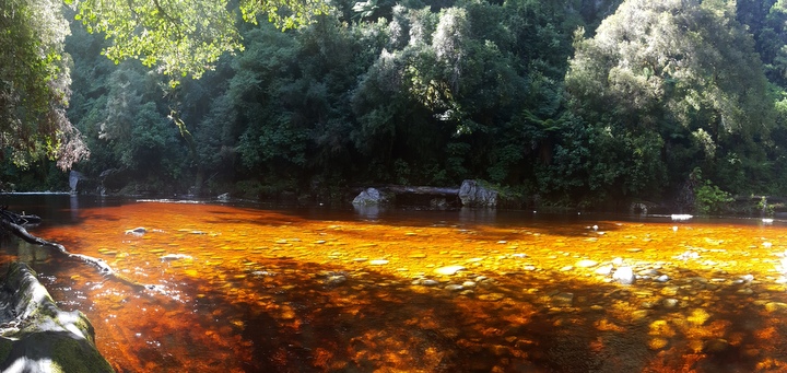
Karamea is the northernmost village of the West Coast. From here we will take a bus to travel the 20 km to the beginning of the Heaphy track, one of the Great Walks. The bikes will fly to the end of the trail. But before that, we take a day to visit the Oparara arch. To be honest, we did not expect much from this visit, but the area has surprised us very pleasantly. In fact, it is part of the Kahurangi National Park, just like the Heaphy track. The first interesting spot is the arch over the Oparara River, the most famous formation. Already on the way to the arch we fall in love with this part of the park. The river waters here are strongly tinted with a caramel color that stands out from the bright green vegetation surrounding them. It's that color of the caramel on top of your mum’s custard. Those you used to eat when it seemed that you could not eat anything else because you had already had half roasted duck, with plums and pine nuts and you had dipped bread in the sauce until satiety. Or several portions of monkfish and hake from the zarzuela (seafood stew), plus a few giant langoustines and cuttlefish. And all that after having had delicious appetizers... Oops... Let's go back to the dyed water topic. The water has that color because of the amount of decaying leaves in the forest floor and the large amount of rainfall. The leaves let go some tannins that stain the water with that caramel color, like the custard... Again! In particular, there is a small beach on a bend of the Oparara River where the river bed has a slow gradient and when the sun shines, it shows the entire range of shades from transparent to that intense caramel color, like the your mum’s custard... On the beach there is a huge tree with an entire ecosystem of ferns, moss and lichen on its branches, elegantly hanging towards the river. A truly beautiful and special corner.
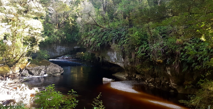
The arch over the Oparara is actually a tunnel excavated by the river itself in the limestone layer. The tunnel is quite impressive. It is 200 meters long, 49 meters wide and 37 meters high. On the walls and roof that get a minimum of light cling ferns and all kinds of hanging plants. The second famous arch in the area is the Moria Arch. This is less impressive in size but more beautiful.
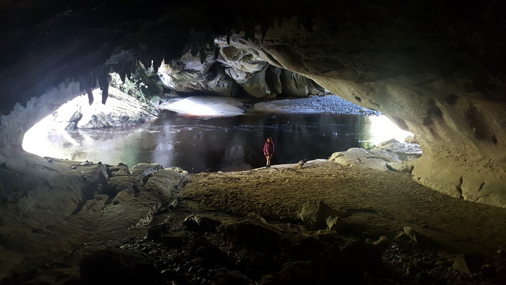
First because it is accessed through a cavern, called the Moria Gate. Once inside, you end up on a beach in the middle of the tunnel. From the roof, water that has gone through the limestone layer drips. The entrance and the exit of the tunnel dazzle with radiant green, while a river of custard flows peacefully at our feet ... Uhhh, sorry. Yesterday, Judit began to cook as if she was possessed. Homemade bread, cocoa cookies, others with almonds, banana and coconut bread... All with an astronomical caloric content and a higher density than lead. Dense and rich. But today, when we arrived at the trailhead, we ate everything we carried, which clearly was not enough... It was rather insufficient and now we suffer hallucinations due to hunger. Nothing that we cannot fix upon returning to the motel...
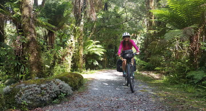
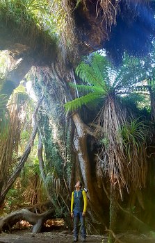
The first of the four days of the Heaphy track runs next to the coast. Most of the route is immersed in the forest, but some sections go on the beach. The forest is bizarre, a mixture of giant ferns, palm trees and beech trees, covered by moss and lichens. The sun blinds you for a few seconds when you leave the forest and step onto the beach. When you return to the forest you need some time to get used to the darkness again. That's how thick the vegetation is.
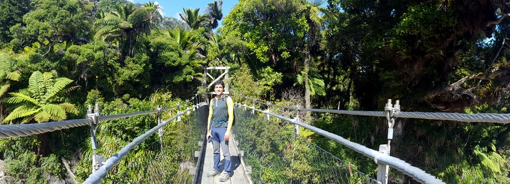
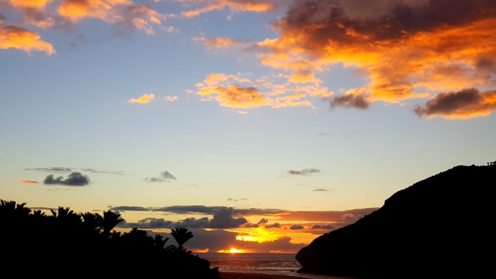
Along the way, the fantails, small birds with a tail as long as the rest of their body, come to greet us fluttering like butterflies around us. Also the weka, a kind of daring and noisy chicken. We even find a shell of the carnivorous snail found in this area. It feeds on worms that gobbles up like a spaghetti. It must be an unforgettable image to see a snail sip a worm... Of course, the snail is nocturnal, like the immense majority of fauna in this country. The Heaphy hut is located just before the trail goes away from the coast. Here we finish the first day and enjoy another beautiful sunset, the last we will see on the west coast.
The second day of the track is even more spectacular than the first. During the first 7 km, we follow the Heaphy River upstream but flat until we reach the Lewis hut. The forest in that area is still as yesterday, but the amount of birds that we can hear is incredible. We spot a group of 6 or 8 bellbirds competing to sing the most complicated song. The tuis try to imitate them, but the accidental squawks give them away. We have fun with the robins, scratching the trail with our foot or a stick and waiting for them to come and peck. We even see a couple of cormorant nests in a dry tree on the river. In the nests there are still some lazy chicks, quite grown up and more than ready to fly away. The most charming are still the fantails, flying almost randomly from branch to branch, following us along the way.
 Also in this area we are lucky to spot one of the carnivorous snails crossing the road, in plain daylight. When passing over it, it hides inside its shell, but after some time, one by one, it stretches the eye tentacles out and begins to come out. The shell of this one is about 6 cm in diameter, but they can get about the size of a human fist.
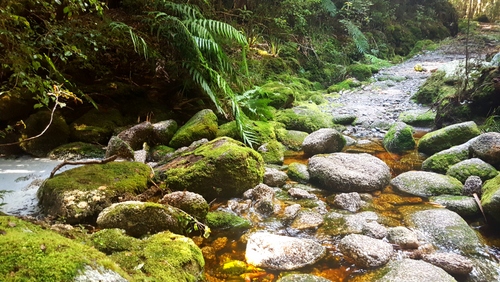 After the Lewis hut, it begins the gentle climb that will last until the end of our day, the MacKay hut. The vegetation changes gradually, from the palm trees and ferns forest to more and more beech trees and giving way to tea trees at 700 meters high. In this climb, the concerts and symphonies of the birds are almost nonstop. The sun filters down only where the thickness of the canopy decreases. The penumbra is almost permanent. The trail meanders in constant climb. On the valley side, from time to time, we can see how we gain elevation with respect to the river.
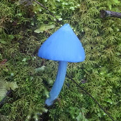
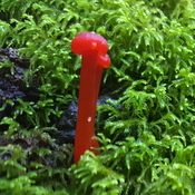
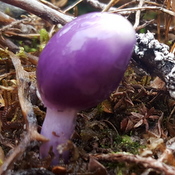
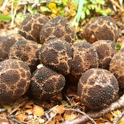
The bank on the mountain side is covered with moss and decorated with ferns and occasionally mushrooms. Mushrooms of all colors. We have all seen brown mushrooms. White are also common. The purple and red ones not so much. The bright red ones are strange, but we had already seen them in the Doubtful Sound. But today we have seen blue mushrooms! The typical mushroom with a conical hat, quite pointing and blue. And no, we had not tried any of them. We were not under any hallucinogenic effect. Today's walk has been beautiful, probably one of the best we've done on this trip.
 The third day of the track is not as spectacular as the first two. Even so, it has several interesting areas. For the first time in 40 or 50 km, the trail passes through an area without forest. It is a meadow of tall grass. This is the preferred area for the takahes, an indigenous bird in danger of extinction, recently reintroduced in the park. But the most we get to see are their poop around the Saxon hut. There we meet the park ranger and she tells us that every day they show up after 4 pm, but not during the day. The most beautiful stretch of the day is the enchanted forest. It’s a stretch of limestone terrain with caves, pointing rocks and moss covered canals. Near the Perry Saddle hut we spot a Weka chick. It's a fluffy dark ball with legs running and squawking like crazy. Their parents have climbed the bank of the trail up the hill, but the chick cannot jump so high and has been left behind. When we approach him, one of the adults jumps down from the bank to protect the little one and moves him away from us with a call different from what we had heard so far from wekas. It seems strange that this family still has such small chick in early autumn.
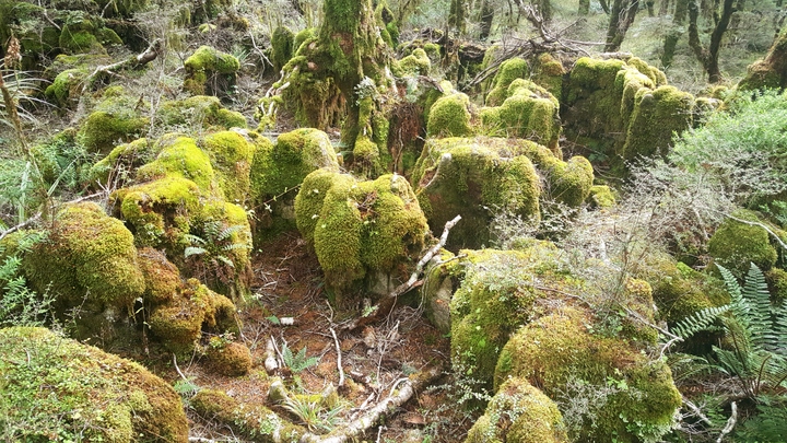
Our last day of the track is a little rushed. At 12 pm we are picked up by a minivan at the Brown hut, at the end of the 17 km descent, to take us to the airport where the bikes should be waiting for us. So we leave at 7:30, before sunrise. It’s still difficult to walk without stumbling. There is so little light that we even see a couple of rurus, a small indigenous owl. Last night it rained. The peaks of the mountains that surround us are covered with the first snows of autumn. The birds are still lethargic by the cold and the rain and it takes a while to start singing. In a couple of points of the road, at some point in time, there was a landslide and the trees have not yet grown. There we can see the clouds covering parts of the valley below. A couple of nights ago, some of the hikers who walked the trail in the opposite direction said that the track from the Brown hut to the Perry saddle was boring. We don’t agree. It’s beautiful. The sun's rays come it filtered at a low angle, selectively illuminating the undergrowth vegetation, highlighting the glittering wet moss or a fern leaves. The wekas stir the leaves searching for their breakfast. Every now and then we cross a crystal clear creek. Even at one spot of the downhill, a drop of water hanging from a branch acts as a prism. Depending on the angle from which we look at it, the drop changes color covering all the rainbow gamut. A magical effect that we had never experienced before.
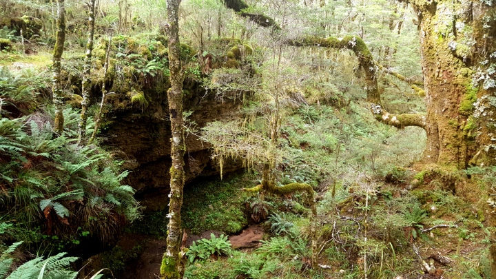
The route along the west coast started a little weak with the disappointments of the Fox and Franz Josef glaciers, but the North section has made up for it. In particular the visits to Paparoa national park and the two areas of the Kahurangi national park (the Oparara basin and the Heaphy Great Walk), being the Heaphy track clearly one of the best we've ever done. Our next goal: kayak across the Abel Tasman National Park. But that will already be in our next story.
© 2018 Explore Pangea. All Rights Reserved. Website Terms of Use.