• GPX file
• Profile bike
• Profile hike
• Logbook
• Where are we?
Photo album:
• Fiordland
Recommended services:
• Deep Cove Hostel (Doubtful Sound)
Did you find our website useful?
THANK YOU!
Leg breakdown:
Date Activity Leg Distance (Km) Elev. Gain (m) Elev. Desc. (m) 24-Jan-19 Riding Queenstown to Mavora Lakes 57.8 516 208 25-Jan-19 Riding Mavora Lakes to Te Anau 70.5 82 485 27-Jan-19 Riding Te Anau to Kiosk campground 65.3 472 307 28-Jan-19 Riding Kiosk campground to Homer hut 35.6 753 336 29-Jan-19 Riding Homer hut to Milford sound and back 42.3 1048 1053 30-Jan-19 Riding Homer hut to Te Anau 102.0 788 1395 1-Feb-19 Riding Te Anau to Manapouri 28.4 133 134 2-Feb-19 Riding Manapouri to Doubtful sound 20.6 554 695 3-Feb-19 Hiking Hanging valley track 6.5 424 438 6-Feb-19 Riding Deep cove to Percy saddle road 22.4 960 534 7-Feb-19 Riding Percy saddle Rd to Borland Rd 12.5 643 711 8-Feb-19 Riding Borland Rd to Borland Lodge 43.6 901 1079 9-Feb-19 Riding Borland Lodge to Tuatapere 56.1 150 311 10-Feb-19 Hiking Hump Ridge Burn to Okaka Lodge 20.4 943 78 11-Feb-19 Hiking Okaka Lodge to Port Craig Lodge 21.5 149 970 12-Feb-19 Hiking Port Craig Lodge to Hump Ridge Burn 19.6 176 152 13-Feb-19 Riding Tuatapere to Riverton 51.4 266 268 15-Feb-19 Riding Riverton to Invercargill 41.0 78 91
January 24 to February 15, 2019: Fiordland National Park
In November of 2013 we visited the surroundings of Queenstown for a couple of weeks. Then Queenstown was already a city living almost exclusively on tourism. Many of the adrenaline pumping activities such as bungee jumping have been invented here. In Queenstown you can throw yourself into the void in thousand ways: from a bridge, from an airplane, paragliding, hang gliding. The last thing is to catapult yourself into the space tied with an elastic rope and fall towards the bottom of a canyon. Adventure companies don’t know what else to do to attract customers. Some offered free bungee jumping if you jumped naked, but they had to withdraw the offer because it had too much acceptance!
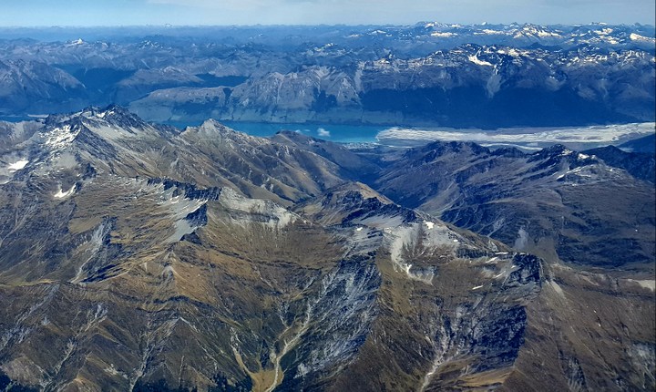
This time we have found Queenstown even more obsessed with this type of tourism. The streets are full of tour operators, restaurants and hotels. The buses pick up and drop off tourists that go and return from their activities. In the sky, at any time of day you can see a lot of tandem paragliders. The tranquility of the walk around the lake is disturbed by loud motor boats at full speed jumping over the waves with its load of tourists. It has definitely become overcrowded and will probably continue to do so.
One of the consequences of this excessive amount of tourists is that there are almost no permits for the best hikes in the area, which in New Zealand are known as the Great Walks. Another is that the prices of huts and camping for foreigners on some of those routes have skyrocketed. For example, the world famous Milford track can cost around NZ $700 each including mandatory accommodation in the 3 huts along the way (they do not allow you to camp) and transport at the beginning and end of the route. It seems excessive, especially considering that the chances of spending 4 days in the rain are very high. In Fiordland it rains 200 days a year... Our only option is to repeat the Routeburn track. Unlike 2013, this time it was impossible to organize to have someone to pick up the bikes at the beginning of the route and bring them to us at the end. We have to do like the rest of the tourists, get on a bus and store the bikes at the campsite while we hike.
After a week in Queenstown planning our next leg around the South, administrative tasks and especially waiting for the start date of the Routeburn permit, we finally left for our first activity in Fiordland. Clearly we have spent too much time in the same campsite. You know it when the other tourists leave and give you the food they have left over. You know it when you already know which of the showers has more pressure and the more uniform stream. You also know it when the waiters in the cafeteria next door welcome you with a special greeting. The worst thing is when you see other cyclists arrive and leave or when those who finish here their trip give you their spare parts. Part of our planning includes grouping our gear into three categories. The first one is the gear we take to the Routeburn, the hike. The second includes the gear and spare parts that we do not need on a regular basis while we ride, but only from time to time: tools to assemble and disassemble the bikes, clothing not adequate for the route of the following weeks, etc. We put all that in a box that we send by mail to ourselves to a place at which we will arrive in a few weeks. In this case, as we plan to return to Queenstown after visiting the South, this box has been inside our tent for a few days and we will store it in the campsite until we return. It's a big box that we got in a supermarket. Its original content was boxes of eggs and has the word EGGS on all four faces. The third category of gear includes the material we need for the bike route but not for the hike, such as panniers, helmets, etc. All this is stuffed in another box that looks like a box of a jamón and has also been inside the tent for a few days. In fact, it has been quite useful. We have used it as a desk for a few days and we are considering to take it with us on the bike 😉 ... But today, Monday, at last, we are on the move.
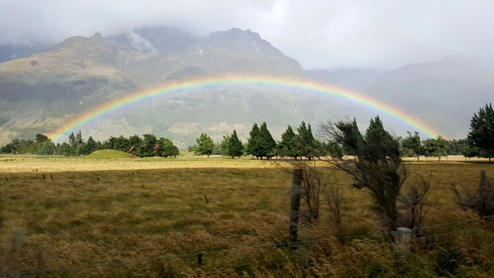
A rainbow welcomes us as we arrive to the starting point of our hike, the Routeburn track. We had never seen one like this, complete from end to end and with all the colors clearly visible. Very nice but of course, when you head towards a rainbow, you know you're going to get wet. Our first day is easy, short and with little gain elevation. As we move along we remember certain points of the trail.
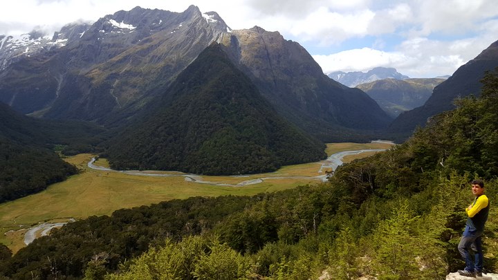
When we get to the meadow where we camp today it’s still sunny. We remember that a little further up there is a wonderful viewpoint of the valley where we are camped, so we decide to climb in case tomorrow the weather is worse. It has been worth climbing to see the confluence of the three valleys in the Routeburn flats. Our second day is the longest but also the most rewarding. The trail starts climbing through the rain forest, luxuriant and humid. When we cross the tree line, the landscape changes radically. At this height only tussock and some bushes survive. As a result, the views are much wider.
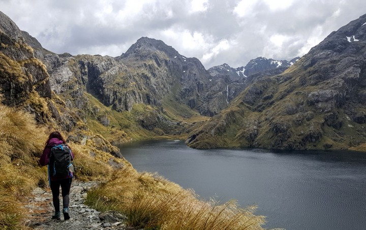
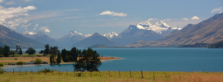
We continue climbing towards the highest point of the trail, the Harris pass. All along that section, the panorama is spectacular: glacial lakes, snowy peaks and creeks that rush downhill almost vertically. In this stretch of low grasses, the wind blows strong and it´s bringing gray clouds from the West, loaded with water. After the pass we flank the Ailsa range, from where you can see very low and between clouds the Hollyford valley where the Great Walk of that same name runs.
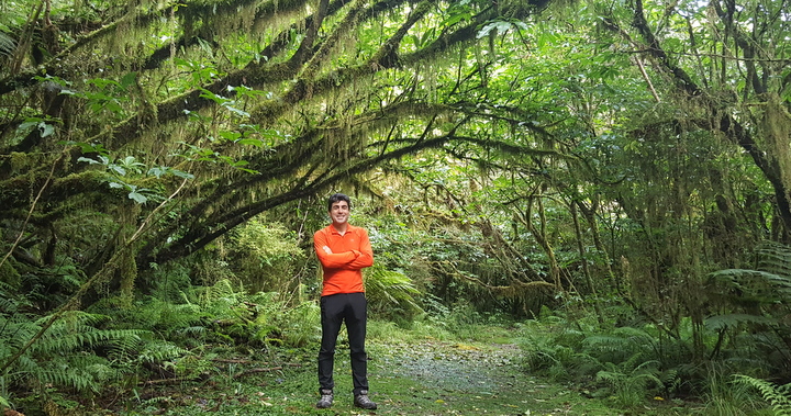
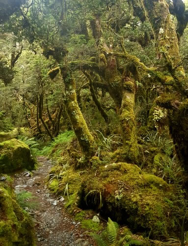 At the end of the skirting, we head down to Lake McKinzie, where our hut for tonight is located. The clouds are already above us and it has started to rain. After some zigzags we go back into the rain forest, but this one is different. There is moss everywhere, on the rocks, on the trunks and branches of the trees, on the ground. It is an enchanted forest. Although the sky is totally overcast, mosses and ferns have surprisingly bright colors, as if they were illuminated by invisible spot lights. As forecasted, we spend the third day of hiking in the rain. It has been raining all night and will not stop until late afternoon. Thanks to this, the Earland falls, today´s highlight has so much flow that creates its own wind throwing water away from the wall. Also thanks to so much rain, the soil can no longer absorb more water. The creeks that cross it are overflown and in several there is no other choice but to get your feet wet up to the ankle. When we reach the end of the route, we are soaked but satisfied with the hike.
Returning by bus to Queenstown, we learn that the storm has damaged several areas, there are numerous fallen trees and some of the highest snow-capped peaks can be seen from the road. In summer!
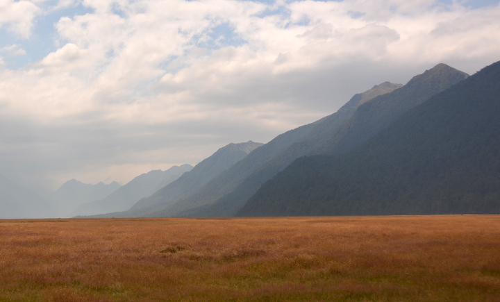
It takes us five days riding to reach the fjord. During the fourth we ride up the narrow valley of the Hollyford River, which we had already seen from the Routeburn route from above. In some sections of the route, the walls of the mountains that form it are so steep that no vegetation can grow there, something unheard of in Fiordland. In those that do have vegetation, they are scattered clearings due to the trees avalanches. In these granite walls there is no soil in which trees can grow roots. Its only option is to grow on the moss and entwine its roots with those of the neighbors, in a false sense of security. When it rains, the moss absorbs water and becomes heavier. If in addition it is windy, the whole thing does not resist and everything slides down, leaving behind the bare granite and the cycle begins again.
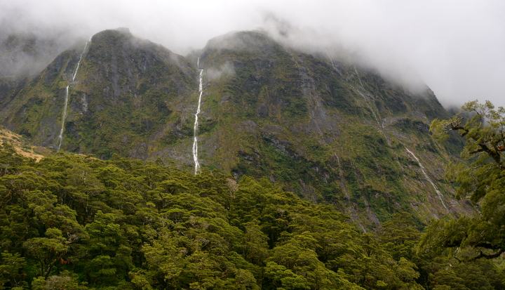
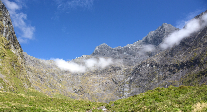
 The dark stone walls are crossed by endless waterfalls. Simply, the rainwater has no alternative but to jump into the void to go down to the Hollyford. It seems that the multiple threads of water compete to arrive faster to the river. Some fall from such a height that the water is sprayed into drops so thin that they are blown away by the wind. They are waterfalls that literally vanish in the air. As we gain altitude we begin to see glaciers. When the sun appears among the clouds, the ice reflects that blue so characteristic and beautiful of compacted ice. The low clouds play between the peaks, swirling, breaking apart and rejoining again. Only for this stretch of the route, is it worth the effort to get here.
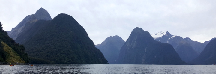
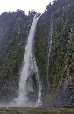
So far we have been dribbling the rain, organizing activities and routes to avoid getting wet. On the day of the visit to the fjord supposedly it should be sunny, but the sky is cloudy. At least it´s not raining. Crossing the tunnel is simple. It's 7:30 am and there is very low traffic. We have knocked on the door of the traffic control booth, but they do not start working until 9. The descent to the fjord is fast and there is almost no need to pedal. It is a pity that there is no viewpoint from which you can see the sound from above. The kayak ride is not amazing but it's ok. We have chosen a route in which a motorboat drops us off at the Sterling falls and we paddle back to port. Just when we start paddling, we find a seal taking care of the fur spiraling around itself to spread the oil secreted by special glands near the hind legs. The next point of interest is the Sterling waterfall. To paddle near a cascade of 150 meters tall and with the flow of this one is imposing. We try to get as close as possible, but the wind that generates the water pushes us back. As we paddle, we look up the magnificent walls and we feel very small. Some of these peaks exceed 1500 m.
The ride back up to the hut is hard but doable thanks in part to the fact that we left most of our bags at the hut. As the day progresses, the weather improves and the sky clears up over the peaks we are heading towards. The range is impassable if it was not for the tunnel. The dreaded crossing of the tunnel on the way up is much simpler than we expected. The control crew has seen us climbing the last zigzags and there is a car waiting for us with a bike rack! They kindly cross us to the other side and problem solved.
The next morning, the prospects of a good dinner in Te Anau, a shower after 4 days, a favorable profile and the tail wind stimulate us to ride the 102 km that separate the hut from Te Anau.
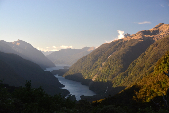
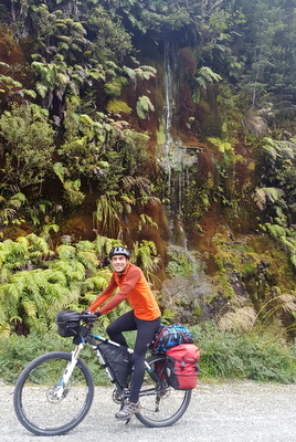 Our next adventure in Fiordland is the visit to the Doubtful Sound, a little further south of Milford. We are going to be away from civilization for about 7 days so we have to buy supplies for the whole week. To reach the fjord, we cycle the 28 km from Te Anau to Manapouri through one of the Great Rides, the Lake2Lake. Once in Manapouri, we cross Lake Manapouri by ferry to the West arm of the lake. At that end of the lake there is a hydroelectric plant, built to feed an aluminum industry in Bluff. The plant converts the potential energy of Lake Manapouri´s water into electrical energy using turbines. The water falls vertically through wells dug in the mountain towards the turbines buried at the bottom of the wells. Then through horizontal tunnels, it continues its course to the fjord. The ferry goes under the high voltage lines just before it arrives to port. The electric lines go up the slope to the ridge. We will follow these lines to leave this area in a couple of days. At the moment we start to roll down the track that takes us to Deep Cove, on the shore of the fjord. First up to the Wilmot pass, where there is a spectacular lookout from where you can see the Doubtful fjord. The orientation of the viewpoint is perfect and although the sky is overcast, you can see some of the closest islands and a couple of waterfalls that fall into the sea. But the fjord is too long and winding and you do not get to see the exit to the sea of Tasmania or the islands more distant like the Island Bauzá. The descent to sea level is great, not only because it is downhill, but because from time to time the vegetation opens up and the fjord can be seen. In the afternoon we take a walk to the Helena falls and to the water outlet of the hydroelectric power station tunnel.
The forecast indicated a cloudy day for our first day in Deep Cove, but there is not a single cloud in the sky. We take advantage of the gorgeous day to climb up to the Huntleigh falls. The relief manager for the hostel where we are staying has suggested a hike extension, up to the ridge at 1100 m, from where there is supposedly a good view of the fjord. We already knew that the extension was going to be a total bushwalking, without any trail. But bushwalking a rainforest in Fiordland is not a good idea. The slopes are brutal, the forest dense with roots intertwined everywhere, gullies everywhere and of course, all super wet and slippery. We t go o the clearing left by an avalanche a few years ago as he told us and we reach the first scramble in which we have to climb rocks covered in moss. We could climb it, but the descent is not going to be fun. If the moss slips off the rock, we would go down with it. So, we're going to miss a great view from the ridge.
When we get back to the lodge, we meet the hostel manager, a very kind guy. He offers to take us to the Wilmot pass lookout in his pickup. The activity ends up being more than we expected. The manager takes his rifle in case we find a deer on the road. Here in New Zealand, deer were introduced by Europeans and is considered a pest, so it is allowed to hunt them without restrictions. Judit goes in front of the car with the loaded rifle between her legs. However, as the manager of the hostel says, today the deer do not want to cooperate. At one of the stops along the way he shows us how to recognize deer tracks and how to know if they are fresh or not. At another point we see 2 blue ducks, a species of duck that lives in fast-flowing streams. Back to the hostel we find the team that is mapping the seabed of the fjord, which have been here for a few weeks. Today they have caught a good size blue cod and some other fish. They also have some venison that one of the team members recently hunted. They invite us to a luxury dinner and we have a good time with them. Among other things they tell us technical details of their work, which is very interesting.
Although the forecast (and supplies) were just enough to spend 2 nights in the fjord, we stay for 3 nights and almost with the same food we came. Apart from the feast with the surveyors, the people in charge of the place have brought us homemade soup, scones with jam and cream, coffee, cookies, fried bananas, etc.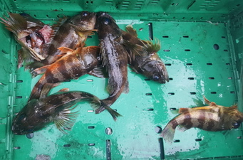 In what was predicted to be our last evening in the Doubtful Sound we go fishing with the hostel manager in his boat. We go in the Hall Arm to catch the bait. We find it incredible that they catch the bait, instead of bringing it. The must be a lot of fish here to not bother bringing it. In fact, the manager catches one in less than 1 minute. We are hallucinating. It takes us maybe 5 minutes but some fish similar to rockfish called Jock Stewart, begin to fill a box that we already have prepared for it. Judit even gets one hooked by the belly! On another occasion she catches two at a time, one on each of the hooks on her line.
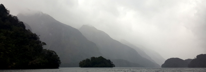
The second surprise is when something big bites the manager’s hook. He starts reeling in the fishing line with effort and we are astonished when we see that it is a shark more than one meter long. The manager takes it out of the water, puts his foot on the gills, removes the hook from a mouth full of sharp teeth and returns it to the water. After a while Cèsar is the one who catches a shark, smaller but still a shark. The excitement is increasing. The manager begins to chop rockfish to make bait and we go back to the main channel in search of groupers. We are about 20 meters from the south wall of the fjord and the depth here is about 60 meters. We drop the sinkers and hooks with bait. Instantly we notice the quick pulls we have just experienced with rockfish. He advises us to wait for the longer and stronger pull of the grouper. However, the groupers do not cooperate today. We take out some more rock fish, which he cuts for us and that will be our food for tomorrow. It's 8 in the afternoon. There is still light but the wind increases and the rain intensifies, so we return to Deep Cove satisfied with our captures. Apart from the excitement of fishing, sailing along the main channel and one of the side arms is beautiful. Perhaps the mountains that enclose this fjord are not as imposing as those of the Milford, but the Doubtful has hidden waterfalls visible only from a certain angle, side channels and islands. It is a much more interesting fjord to explore. Besides, it does not have the ridiculous bustle of the Milford. No airport, no impertinent helicopters doing tours, only us three fishing and sailing. In short, an unforgettable experience, thanks above all to the kindness of the people who live here. Upon our return to land, dinner awaits us at his home. His wife has cooked a sort of stew that we swallow with pleasure. If all this was not enough, when we go to our room, we go through the community kitchen of the hostel to leave the fish fillets in the refrigerator and we find a note from the substitute responsible telling us that he has left us ice cream and apple pie! This place is a singularity on the planet. As we remember the adventures of this afternoon, the size of our catches begins to increase and the shark that Cèsar has caught almost took off his arm when he remove the hook... Better we finish here today's story before the fisherman tale becomes incredible.
The next morning, while we stretch, we count the days we need to get to Tuatapere, the next town to the South, once we leave Fiordland. We have to arrive on Saturday to start the Hump Ridge hike on Sunday. Today is Tuesday and we need 3 days to get to Tuatapere. So we have an extra day, which we can waste it in Tuatapere or take advantage of it here... The decision is not very difficult. We stay!
The day starts slowly but will accelerate progressively until midnight in a sequence of exciting, wild and magical experiences. In that order. Cèsar talks to the manager about our new plans. He finds him in the shed where the turbine that provides us with electricity is. In the lake above the Huntleigh falls that we visited yesterday, there is a dam to ensure the water supply to the hostel and the turbine. The manager has started the backup diesel generator to take a look at some strange noises in the turbine. Also, according to the indicators on the control panel, it’s generating less power than it should. Cèsar helps him with the repairs. In the end it ends up being a pile of leaves, dirt and twigs that had accumulated in the inlet valve. Once unclogged, they re-assemble everything, open the valve and all solved. We also give him a hand in the garbage collection and go with him to the West Arm port to drop it in a container there. During the trip we make plans for the rest of the day: in the afternoon we go fishing without him and at sunset hunting.
This time we go fishing on our own. Well, we get help to prepare the boat and start the engine. As it is a bit windy and there are some white caps in the main channel of the fjord, he recommends a sheltered area and we will tie the boat to a buoy. Once we reach the buoy, we throw the hooks but after 2 minutes nothing happens. We are doing something wrong, very wrong. This did not happen yesterday. We start looking for reasons for this disaster. Surely it's the bait! We're using frozen chicken breast! There is no way to catch anything with this! Who has seen a fish eat chicken? Hold on. What are those pulls on the line? Cèsar begins to reel in the line and takes out a good size fish called Tarakihi. Our dinner has just arrived. After a few minutes, it's Judit's turn. Strong pull and then silence. She start reeling in. The line is heavy but there are no more pulls. She keeps reeling in and it turns out to be a shark. Oh my God! Now what? The shark twists on the surface of the water and gets entangled with the line. What a mess! Judit brings it out of the water and Cèsar grabs him by the back of the neck watching those small but surely sharp teeth. The hook is between the jaws. The shark's eyes are gleaming light green. Maybe it’s due to the pressure of Cèsar's hand squeezing him so that he does not move. Okay, we already have him immobilized. Now we have to untangle him, remove the hook as quickly as possible and with the minimum possible pain. Well, that's the theory. The practical implementation differs a little. The first phase is simple. A few flips, a wiggle here, a shake there and have the pectoral fins released and the tail loose. In the second phase is where the theory goes south. The idiot does not let go of the hook. Cèsar does not have much practice as a dentist and the poor shark does not open his jaws enough. In the tug of war, a thin trickle of blood appear in the mouth. The shark’s mouth, not Cèsar’s. The hook keeps poking but after a few more efforts, the hook is finally released. The poor beast is stiff. Cèsar a little bit too. The documentary scene with a happy ending, where the shark gets dropped in the water and begins to move its tail and slowly swims away, does not happen. The poor animal sinks into the dark waters of the fjord and disappears. We hope he recovers. Fortunately for sharks, their teeth grow in rows; while using the outer row, another grows behind and will move outwards when fully formed. We hope that is the case for our victim. Then Judit catches one of those rockfish that we used yesterday for bait, but this one is a little one, so we return it to the water, this time happily. The wind is blowing stronger, so we pick up the lines and return to port with our Tarakihi.
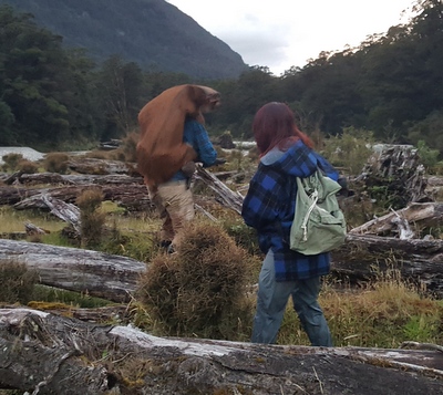 If fishing, and especially the shark episode, have not been exciting enough for the day, our next activity is a hundred times more intense. We're going deer hunting! Of course, we are just looking. During the drive, the hunter explains how to behave: basically walk after him, no noise and no talking. With few expectations and a lot of skepticism, we leave the SUV behind and enter the forest on foot. On a sandy shore of the river Spey we see the first fresh, very fresh deer footprints. The hunter looks at us with his forefinger on his lips and a straight look to make very clear that this is serious. The footprints take us back to the forest. The hunter already knows where we are going, his favorite clearing. We duck at the edge of the forest, on a raised bank of the river. On the other shore, at about 150 meters there is a clearing between the trees and the water. He is comfortably positioned on the ground with the rifle aiming towards the clearing. After a few minutes he begins to look through the rifle scope and makes us a gesture that he has seen deer. We do not see anything. We look harder, decipher any suspicious patterns and scrutinize all dubious shadows. Bang! The explosion of the shot catches us by surprise.
All our disbelief has disappeared as fast as the bullet from the barrel. Our sight is still stuck in the clearing on the opposite shore. We have not yet had time to react when we see a female and a fawn jumping and disappearing from our field of view. We turn our heads towards the hunter and he continues to observe through the rifle scope but without reloading his rifle. It seems he is sure that his shot has reached his prey. We are still speechless. We look at each other and we do not understand what has just happened. After half a minute he gets up, spits out the lethal shell, reloads the rifle and shows us the way to go find the trophy. What? Seriously? We have seen a couple of deer escape, but we don’t know how many there were. We follow the hunter in silence from our hiding place to an area to access the river. The water reaches our knees and the current is strong enough so you don´t want to slip. Once on the other shore he tells us again to be quiet. More tracks. We can almost feel the adrenaline rushing through his veins. Even us, we can recognize that the tracks are from two deer of different sizes and that they follow an erratic trajectory. We are still stunned. We follow the tracks a few meters, but it’s clear that these are the two that have escaped. We go back to the clearing in search of the body or blood. Then the hunter enters the forest through a place that seems random to us. In a couple of minutes he finds his kill. We are petrified. Everything has happened so unexpectedly but so real. Thinking back, we have done what seems logical but it is still inconceivable that we have a dead deer at our feet. An hour ago we were cleaning fish on the shore of the fjord... The images we will see next are even more amazing if possible. The hunter draws his knife and with some quick cuts he slaughters the deer. While waiting for him to bleed, he sharpens his knife, preparing for the job. With precise cuts and very naturally cuts open the belly and removes all internal organs. In less than 10 minutes the deer is turned into a backpack and ready to be carried and transported to the SUV. As we ford the river back we begin to digest what we have just experienced.
The hunter is carrying the deer on his back, Judit the hunter´s backpack and jacket and Cèsar the rifle. The three of us cross the river while the daylight is fading. We arrive at the other shore. We react and begin to pound him with questions. We receive very sincere answers and, above all, very logical ones. There has been no show or arrogance, everything has been a very clean and natural process. Although we remain astonished, internally debating what we have just witnessed (perhaps a product of our exclusion from the natural world, of our immersion in a society that feeds on provisions that magically appear on the supermarket shelves). Maybe what we just experienced should not be so alien to us. Okay, there is one less deer in New Zealand, but theoretically there should be none. They are not part of this ecosystem. Or at least they were not before the arrival of Europeans. There is an open debate about whether deer should be considered a plague. We load the deer in the car and returned to the hostel. For the hunter has been a successful night but in its normality. For us one that we will not forget. In the hostel while we prepare dinner we remember aloud the scenes. We are cooking the filleted Tarakihi and the Jock Stewarts that did not become bait yesterday. What's more cruel, shooting a deer and dying instantly or in a few minutes or letting the fish agonize shaking on the deck of a boat until they suffocate? Why does the first thing seem like a barbarity and the second more excusable? Is it because the deer is a mammal? Because it is larger? Because it bleeds like us? Why is the deer in our modern society a graceful animal to be cared for, while a vulgar fish can be ignored while asphyxiating?
Our last activity of this fast-paced day helps us recover our mental balance and relax. Less than half a kilometer away from the hostel, in a curve of the road, there is a cliff covered with moss and ferns. That wall, at night, becomes part of the sky. It's almost midnight and the sky is clear. When we approach the moss wall we turn off the headlights and let our eyes adapt to the darkness. Meanwhile, we look at the endless stars. We unsuccessfully search for the Southern Cross, a constellation the sailors used in the Southern Hemisphere to travel. After a few minutes, the stars of the moss wall begin to twinkle. They are all blue stars, much more intense than those of the sky. With the movement of our eyes they sparkle, appear and hide behind the ferns. There are hundreds of glow worms on this wall! And in the gutter of the opposite side of the road too. We are surrounded by bright little lights. We cannot stop rejoicing at the sky and the moss wall. The transition is clear, but the magic of the place makes it blurry. For some unknown reason, at a certain moment, both of us look at the starry wall towards the sky and receive the signal that the day is complete: a shooting star. The yellowish line crosses the sky between the constellations towards the wall of glow worms, forcing us to lower our heads again. It is already past midnight and while walking back to the hostel we wonder why this place is so special, why it has everything, waterfalls, twisted fjords, a sea and a forest full of life and so hospitable inhabitants living in harmony with the environment. We do not have answers, neither need them. We have just experienced an unforgettable experience thanks to all of them and the beauty of the place.
The main problem of this route is that on the other side of the pass, the slope of the mountain is too steep for a road to be built. For the power line it is not a big problem. Simply the first pylon on the other side of the pass is much further down the hill, in an area where you can already build a track. From the hill you can see a looong catenary and a smaaaall pylon below. Between the pylon of the pass and the first on the other side there is only 1 km. But what a kilometer! Doing it on foot is a killer but doing it by bike is a total nonsense, especially when you've done it once. You don’t even have the excuse that you didn’t know. In the first part of the descent you have to cross a scree slightly supported by mosses and small grasses. If you slip, you go down, down. The trail to follow is very faint. On the one hand because of avalanches and landslides and on the other hand because there are not enough idiots to go thtough it to prevent the vegetation from reconquering it. The bike goes on the valley side and the idiot on the mountain side, so if the bike slips, it doesn’t drag the idiot down the slope. The truth is that you have to have some ability to traverse this area. If you lock the rear brake, the rear wheel slides down. But if you lock the front one, then you have a serious problem, because the handlebar follows the wheel and if your hands do not follow the handlebar, you can say goodbye to your bike. From time to time the pedal that is on our side decides to change its position without warning and on your shin will notice on the next step. In another situation you would drop the bike to massage the area and yell, but here you clench your teeth, reposition the pedal and continue as if nothing had happened. At some point, we get the impression that the bikes make fun of us with a shrill giggle, like the psychopaths do on horror movies. Maybe it's just the brakes squeaking. At what point in time did we decide to repeat this ordeal? As you can imagine, all this cannot be done with the panniers mounted on the bike. First you carry the bike down a stretch, then you go up to find the panniers and the backpack and go back down again overcoming all the same obstacles. Then repeat the process for the next stretch. When you carry the panniers down, you put into practice your trapeze skills. With the backpack on your back and a pannier in each hand, you have to keep your balance when the rocks slide downhill at every step. In those moments you pray everything you know so that the rock that is slipping catches on something before the instincts let go the pannier to sink your nails into the ground. The thought of the pannier tumbling downhill increases your faith.
The second part of the crossing is through the forest. There you have to do some bush walking, go down granite blocks covered with moss and go through fallen logs, of course also covered with moss. Here begins the next circus performance: the clowns. It consists of a cyclist dressed up in bright colors with a bicycle on his shoulder passing over a slippery trunk. With the seat digging into the trapezius muscle and the hand grabbing the frame near the pedals, the show begins. At the first slip, you let go your hand of the frame to grab onto any nearby branch. When you regain control you grab the bike again but placing your hand slightly further back and your fingers land on the chain and get dirty with the lubricant. Meanwhile, the seat is still sinking and already reaches the collarbone which forces you to tip your head in a ridiculous way. You reach the other end of the trunk and leave the bike. You turn around and cross the trunk again in search of the panniers. You remember that your fingers are full of lubricant too late. Now your fingerprints are on the clothes, the panniers or both. That lubricant never stays on your fingers, it always expands. Chain lubricant is one of the materials in the universe to increase its entropy faster. The third pass through the trunk is like those attractions in which the spectators suffer for the trapeze artist. With the backpack on our back and one pannier in each hand, the crossing begins. To keep your balance you should extend your arms. The deltoids try, but the weight of the panniers will not let them. The public fears that Cèsar will slip and fall with one leg on each side of the trunk. So, moving like a grandma with a walker, dragging our feet along the wet trunk, we reach the end for the second time, to realize that a little further on there are more trunks. At what point in time did we decide to repeat this ordeal?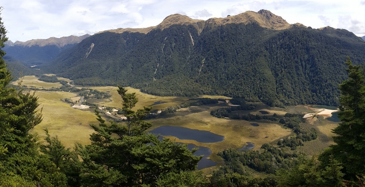
That kilometer takes about 4 hours. If you still have an interest in doing this heroic traverse, you can read the detailed description with waypoints from the first time we did it in 2013. Once you reach the first pylon on the other side of the pass, the road is in such bad condition that, although it’s downhill, you cannot ride the bike with all the weight we carry. The track is quite steep and is full of rocks, just about the size that if you are ride it, sooner or later, the front brake will lock and the crash will be spectacular. So we walk the bike down with some slips, but without falling. Finally we reach the valley where we can finally pedal. We spent almost 8 hours between the ascent to the pass and the descent to the valley. The plan was to camp in the lake’s South Arm campground but we know that there are endless sandflies there, those beasts created by the devil, half mosquito half tiny fly that drives you crazy and whose bites sting for more than a week. We are so tired that we decide to camp in the first decent space. It seems that the sandflies have come here for summer. We beat the Guinness record in setting up the tent and getting inside. The next step is to eliminate all the sandflies that have sneaked in the tent with us. At the end of that process, the floor of the tent is a cemetery of corpses. At least the damned sandflies are easy to kill. The next day we cross the Borland pass (990 m), where some of the slopes do not respect the Hague Convention. In short, it takes us 4 days to reach Tuatapere, after 135 km and more than 2500 m of elevation gain, sandflies and a lot of suffering. Please, if you are thinking about doing it for the first time, read the detailed description again. If you are thinking about repeating the route, you are a lost case.
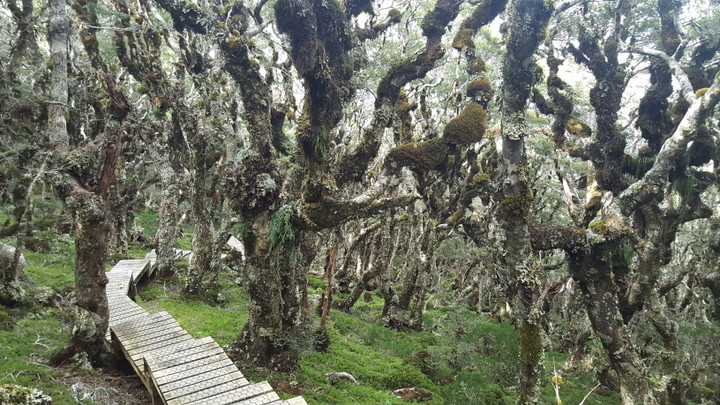
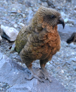
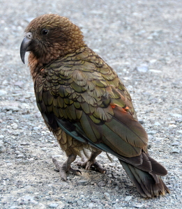
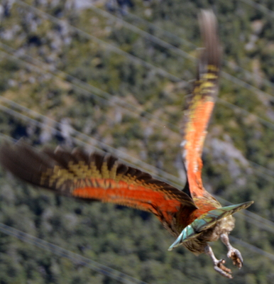
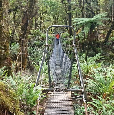 The day after arriving in Tuatapere, we started a hike through the southernmost foothills of the Southern Alps, the Hump Ridge. Another beating. We are going to have to take a vacation to rest from the holidays. 62 km in 3 days with more than 1000 meters of altitude on the first day. The hike is ok, but the rain forest no longer surprises us like in the beginning of our trip. In some sections of the forest there are quite a few birds: bell birds, New Zealand pigeons, southern robins, keas. In particular there are a lot of fantails, a bird smaller than a sparrow, but with a longer tail with black and white feathers that unfold like a fan to attract attention. They are very curious and come very close fluttering almost like butterflies. We also see a pair of black fantail, a genetic variety that does not have white tail feathers. In one of the shelters, a couple of keas, the alpine parrots, wake us up in the morning and let themselves be photographed at dawn very up close. On the third day of hiking, one of the stretches is along the beach and from there we see Hector dolphins, a protected species found only in New Zealand.
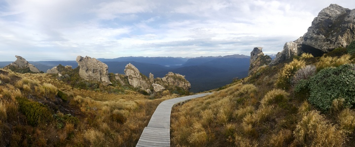
We said goodbye to the Fiorland National Park, a corner of New Zealand that contains many natural gems. In our case, we have to add a lot of unforgettable experiences.
© 2018 Explore Pangea. All Rights Reserved. Website Terms of Use.
